From 150 Things to See, Do & Love: Joshua Tree National Park:
1. Skull Rock Nature Trail
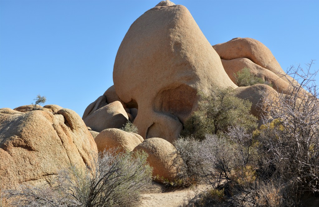
Skull Rock Nature Trail in Joshua Tree National Park is a spooky season favorite! Desert adventurers and wild buccaneers this autumn are going to want to unfurl those maps and discover a trove of desert treasures on this moderately easy 1.7-mile (2.7 km) loop around Joshua Tree’s spookiest star, Skull Rock! Skull Rock, a roadside favorite, guards a loop trail around a cache of natural wonders in the heart of Joshua Tree. Way signs along the nature trail reveal the park’s best surprises.
Skull Rock haunts the Mojave Desert .7 miles east of Jumbo Rocks Campground, right off of Park Boulevard. Convenient parking is available at the pullouts on both sides of the road. The trailhead for Skull Rock Nature Trail is on the south side of Park Boulevard, near Skull Rock. This entrance will take hikers to famous Skull Rock first, and then around the trail in a clockwise direction. (There are also trail entrances at Jumbo Rocks Campground, and on the north side of Park Boulevard.)
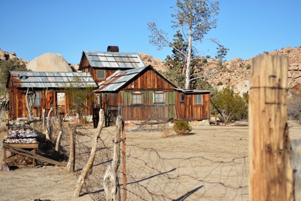
2. Desert Queen Mine

This fall dip into darkness on the Desert Queen Mine trail! Hold on tight as the lawless west and a wild world of lucky strikes, murderous outlaws, gunslingers, big spenders, and lots and lots of gold call from the grave on this easy .5-mile (.8 km) to 1.6-mile (2.6 km) out-and-back hike to Desert Queen Mine! Desert Queen Mine was one of the most profitable mines in the park… and one of the most sordid. Her nomination form to the National Register of Historic Places ominously states that she “…brought death rather than fortune to [her] discoverer…” And indeed, this hike packs more drama than a western serial, with plenty of nooks, ruins, and artifacts to explore on an unforgettable jaunt to the historic mine site. Physically, the hike is easy, but is your spirit strong enough to visit the dark queen?
Desert Queen Mine Trail is located at the end of Desert Queen Mine Road, about 200 feet northeast of the intersection of Desert Queen Mine Road and Queen Valley Road. (Desert Queen Mine Road can be found off of Park Boulevard to the north, opposite Geology Tour Road.) Desert Queen Mine Road and Queen Valley Road are dirt roads with washboard rippling, usually easily passable by car. Three trailheads (Desert Queen Mine, Pine City, and Lucky Boy) leave from the parking area at the end of Desert Queen Mine Road. Signage near the parking area points to each trail. Double-check before starting your hike that you’re heading down the correct trail. The trail to Desert Queen Mine leaves from the northeast end of the parking area, to the right of the primitive toilet.
3. Ryan Mountain
Ryan Mountain Trail is a fantastic October challenge! Ryan Mountain Trail offers some of the very best fall panoramas in the park, and is also one of Joshua Tree’s most difficult hikes. The trail ascends 1,050 feet (320 m) over 1.5 miles (2.4 km) up stone-cut steps and a packed-dirt path to the top of the mountain, making for a strenuous 3-mile (4.8 km) out-and-back hike. While the slopes of the mountain are bare and exposed due to deforestation by past mining operations, the trail’s awesome views into the heart and soul of the park and beyond draw hikers in droves. 360-degree desert and mountain vistas abound, from interior views of the Wonderland of Rocks to the north, Pinto Basin to the east, the Hexie Mountains to the south, and the Little San Bernardino Mountains to the southwest, to the major peaks of Mount San Gorgonio and Mount San Antonio beyond the park’s boundary. However impressive the view, the trail’s serious elevation gain makes it extra-challenging and beyond the skill level of most novice hikers.
Ryan Mountain Trail leaves from the Ryan Mountain parking area off of Park Boulevard, 2.1 miles east of the intersection of Park Boulevard and Keys View Road. The parking area is on the south side of Park Boulevard.
4. Lost Horse Mine
Tales of outlaws, cowboys, miners, claim jumpers, and hidden gold fill the hills of Lost Horse Mine! Join the thrill by following an old rocky wagon trail up to the site of the most profitable mine in Joshua Tree’s history, while soaking up the park’s colorful past along the way. This moderately difficult 4-mile (6.4 km) out-and-back hike brings adventurers to Lost Horse Mine, where the remains of a mine shaft and the ten-stamp mill that crushed and processed a whopping 5 million dollars of gold and silver still stand.
The trail to Lost Horse Mine begins at the Lost Horse Mine Loop trailhead, which is at the end of Lost Horse Mine Road, one mile southeast of the intersection of Lost Horse Mine Road and Keys View Road. The hike starts at the trailhead at the end of the road, at the southern end of the parking area. (The return loop ends .1 miles earlier at the road.) Note that the hike is out-and-back, and although you’re hiking along a loop trail, after visiting the mine you’ll retrace your steps back the way you came to conclude the hike.


You must be logged in to post a comment.